Road Trip

Whidbey Island

My husband, Nali, and I were invited to spend the past weekend on Whidbey Island with friends. We started off the weekend with a leisurely hike at Ebey’s Landing. It’s one of my favorite winter hikes and the sun even came out for us, just a little. The trail starts off parallel to farm fields speckled green with winter plantings. The lush green rolling fields reminded me of my home state Pennsylvania.

Soon the trail comes to a tee at a bluff overlooking the Puget Sound and the Olympic Mountains. The ferries and container ships crisscrossing the Sound looked like bathtub toys from our vantage. As we headed up to the right, a hang glider swooped overhead with a red, white, and blue sail. We waved and Nali barked at him, startled from his sudden appearance. From there its a short climb to the long winding section along the top of the bluff.

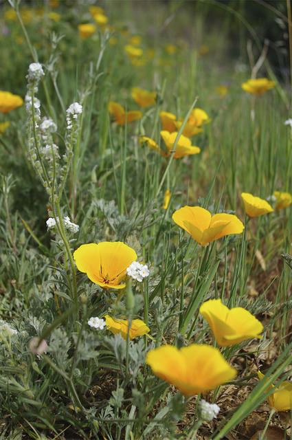
We admired gnarled trees and the winter textures of the dried grasses, oregon grape, and thick thorny bushes. It’s nothing but grand views from the bluff trail. A driftwood covered spit carves out a large lake of green water, calm compared to the opposite side where big frothy waves crashed. Toward the end of the bluff, the trail switchbacks down to the beach to make a loop.

On the beach we turned into the cold headwind and I wished I had a scarf. We scattered out, heads down and hands in our pockets scouring the surface for anything interesting. Nali found and ate some dried bull kelp and dug holes to find who knows what.

By the time we reached the stairs to return we were quite frozen. The incline back up the hill was welcome as it generated some body heat. On the way back we passed by Isaac Ebey’s old home and blockhouse.

Ebey was the first settler on Whidbey Island in 1850 and he and eight family members lived in the house while they farmed the neighboring prairie land. The blockhouse was built as defense in response to continuing conflict with the Native Americans who were displaced from their land. Ebey lived there until he died in 1862. He is buried at the Sunnyside Cemetary, just across the road from the trailhead.

We returned to the cabin just in time for sunset. We poured some cider and headed to the deck with our cameras. The sun lit the clouds in gold as the air grew colder. We went inside and warmed ourselves by the wood stove.

The next morning we explored Langley. Well, mostly we explored the bookstore, Moonraker Books, admired enormously chunky Italian yarn, and grabbed some great coffees. Then our friends made us marvelous cheddar rolls for lunch. After a never ending January, it was the perfect winter getaway without getting too far away.

Hikes featured in this post:
Ebey’s Landing

Road Trip

Paradise, Mount Rainier

Here in Seattle we are lucky (or perhaps you could say unlucky) to have a spectacular volcano watching down on us. Mount Rainier is an active stratovolcano about 60 miles from the city and at 14,400 feet holds plenty of snow to explore all year round. But in the winter time the mountain is especially magical.

The road to Paradise, on the southern side of the mountain, is plowed in the winter for your snow-loving pleasure. The wide open meadows beyond the Paradise Inn beg for sledding, skiing, and snowshoeing. If you are lucky you will get spectacular up-close views of the mountain. The weather up here is famously temperamental. Even on a seemingly blue bird day, clouds can form spoiling your mountain views and even cause whiteouts making it essential to always be prepared in this area. But the extra preparation is worth the hassle to spend a day in paradise.

5484802526_66df86485b_z

My favorite destination from Paradise is Panorama Point. The way weaves through occasional snow covered trees to Glacier Vista, from here climb steeply along the Nisqually Glacier to fantastic views of Rainier and the surrounding mountains. This is the perfect spot to take a rest and fuel up for the return.

My favorite account of life on Mount Rainier is from Floyd Schmoe’s book A Year in Paradise. The book starts out with Floyd describing his honeymoon. He was encouraging his new wife, Ruth, to continue up the mountain on snowshoes. “Come on dear, it’s just over the next ridge,” he told her, her first time ever on snowshoes. They were not just taking a leisurely jaunt up to Panorama Point, they were breaking trail all the way from Longmire at the base of the mountain to Paradise Inn at 5400 feet!

The year was 1920, long before they plowed the road to Paradise, and Schmoe was assigned to man the inn over the winter. His boss told him, “I predict that if you two kids survive this winter alone in Paradise you will live happily together for the rest of your lives and go to heaven when you die.” Then he told him that the inn was covered in 30 feet of snow, and each of its rooms were in complete darkness!

The young couple made the best of their time at the inn. They explored the area on snowshoes in the morning looking for prints in the fresh snow and putting together the stories of the winter wildlife. They dug tunnels in the snow to the windows of the living room to bring some light in. Ruth practiced the piano and honed her high-altitude cooking skills by trial and error. Floyd read books and reported the weather daily to the Weather Bureau in Seattle. Soon they determined that Ruth was pregnant and Floyd built a cradle from the local Alaska yellow cedar as Ruth made baby clothing. Finally they began to notice the ptarmigan and rabbits slowly transforming their coats from brilliant white to brown and black. After their long first winter together in Paradise, it was finally spring.


51VXHPdVnjL._SY344_BO1,204,203,200_

A Year in Paradise by Floyd Schmoe
That winter in Paradise began Schmoe’s long and wide ranging career at Mount Rainier National Park. He was a caretaker and later a mountain guide until he enrolled at the University of Washington and earned a degree in forestry. He then became the first Park Naturalist employed by MRNP. His memoir recounts his memories and experiences in a sort of almanac divided into seasons of the year. His beautiful stories and observations are a must read for anyone who has fallen under the spell of “the mountain.”


Hikes featured in this Post:
Panorama Point Snowshoe

Road Trip

Northeast Part 3: New York & PA

The next morning we said our goodbyes as my mother-in-law stuffed our bags with apples and snacks and we headed out to catch the ferry to New York. The gusty cool autumn wind formed white peaks on Lake Champlain and I bundled up to run out of the car and snap a photo of the boat. As we waited, another ferry boat pulled up to the dock and unloaded. We watched several cars disembark and then, no joke, there were probably ten tractors that roared off the boat like a small town parade. We chuckled as the proud owners waved and we waved back.

This was just our first indication that we were traveling to another world, a place deemed “forever wild” when it was saved from deforestation and declared a park in 1892. While we crossed the lake we planned our route via paper map. Our smartphones could not help us find the most beautiful way through the mountains or the direction to go to spy the most lakes. Anyways there was no cell service in many areas we would be driving through. For a while we were free.

As we weaved through the windy roads we marveled at the unique architecture and outdoor furniture style of the area. It reminded me of my dad and his house full of mounted animals, a bear rug and rocking chairs made of twigs. The leaves here were the brightest and most colorful we’d seen yet. People with phones held up packed into small turnoffs along the roads. We planned to stop for a hike and thought we were clever but getting a few miles off the road, but we got a big dose of reality when we saw cars lined up for miles along the forest road. It was a short hike and we figured we would have to double the distance to include the walk from the car to the trail head. We decided to skip it and stop instead for brunch in Lake Placid.

The sun hovered above the horizon as we scanned the last of the Adirondack lakes for moose (we didn’t see any) and the way became flatter and filled with corn fields and farms. This was the beginning of the familiar territory that I recognized as my home land. The sunset colored the endless fields with a soft yellow glow. We counted deer in the fields between tiny towns as we crossed into Pennsylvania. By then it was too dark to see much, but we would see more in the days to follow. I was home.

The next day my dad took us to my favorite outdoor places growing up. He took us the “back way” on gravel roads bearing my maiden name through yellow and orange hardwood forest. I kept my eyes peeled looking for wildlife like I always did as a kid while driving through the forest. We drove to our old cabin filled with memories of family gatherings, lots of cakes and cookies (I inherited my sweet tooth from my dad and his five brothers), card games and laughter. On the way we stopped at a overlook where my uncle’s ashes were spread.

While driving back, we spotted a beautiful white church across the road from an apple orchard. I asked my dad to stop so I could get some photos. While I took photos my dad wandered through the tiny graveyard next to the church. He found that almost all the gravestones had our family name on them. He’s driven by that church more times than you could possibly count but had no idea that we might have relatives buried there. It was a beautiful discovery.

Lastly we stopped at Halfway Dam, a small lake with a sandy beach where I spent many a summer day with friends and family. I remember running wet and barefoot through the stone structures built by the CCC to the concession stand to buy popsicles and hotdogs. I hadn’t been back there in years but it all came back to me like it was yesterday. These places are so ingrained in my being. My family’s roots run deep here in central PA and we can trace our ancestors back to the Revolutionary War. And no matter how long I’m away, it will always feel like home.


Road Trip

Northeast Part 2: Vermont

This year I’m thankful that I got to spend time with my family, especially outdoor time. Our next stop on our Northeast road trip was Vermont, my husband’s home state. We started off our visit with his family with a bike ride in the Northeast Kingdom. Well, actually we started at The Museum of Every Day Life, which is exactly what it sounds like. It is a small barn on the side of the road with exhibits of matchbooks (including erotic ones displayed behind a curtain), paperclips, toothbrushes and a special exhibit on dust. There was dust from the moon, Mount Saint Helens and the Sistine Chapel. They even tackled big questions like, is belly button lint a form of dust? It was surprisingly philosophic, endlessly entertaining, and very Vermont.

We continued on our way to Barton where we began our bike ride. The weather was beautiful and the fall color was just starting to get good. We biked to Lake Willoughby, a long narrow lake framed on both sides by colorful mountains and is apparently sometimes referred to as the “Lake Lucerne of Vermont.” Is that right? I said as I chomped on an heirloom apple. It may not truly be like Lake Lucerne, but still gorgeous in its own way. Our next stop was the Old Stone House in Brownington which I was thrilled to arrive at to give my tired legs a break. The building was originally called Athenian Hall and was a boarding school run by the first African American to serve in state legislature, Alexander Twilight. Now it’s a museum that houses exhibits of 19th century life.

We started the next day off with a visit to Morse Farm for maple creemees and to stock up on maple syrup. It was cold and rainy but we couldn’t resist the urge to have some maple flavored soft serve for breakfast. Once sugared up we headed to an old granite quarry. Vermont is well known for its high quality granite and along with it, a community of talented carvers. The path we took was riddled with carvings on the rock faces. It was fascinating to see the artwork blend into nature around it. If you weren’t paying attention you could walk right by them.

The path led to ice blue ponds surrounded by shear cliffs and curved wooden boardwalks labeled as a roller coaster for mountain bikes. Large smooth cut pieces of granite jutted out of the ground at strange angles like an abandoned graveyard. We found numerous artifacts and old rusted tools laying in the stands of white birch and stopped to admire the views at overlooks. Just before the end of the trail we passed a happy young couple with a picnic basket. They just got engaged. Then we saw candles lining the end of the trail at a lookout. How romantic.

Our last day in Vermont was my husband’s birthday and we wanted to hike up into the Green Mountains to celebrate. We headed to Camels Hump, a local favorite. The mountain is recognizable by its distinctive hump and as the third highest mountain in the state, can be seen for many miles in all directions. It’s even featured on the Vermont state quarter.

There are many trails through the state park that lead to the summit. We took a steep and rocky path through hardwood forest and red and yellow foliage. We passed many people heading down enjoying the beautiful fall day. About halfway up we stopped at a clearing with views to the top. The hump rose abruptly and I wondered where the trail would traverse. I would soon find out as we broke above the tree line.

We skirted around the steep face of the hump on bare rock like mountain goats to the more easy going side. Then we entered a stand of stunted pine trees. As we climbed a bit more we got a surprise. The tops of the trees and the rocks above us were covered in a layer of hoar frost. The last push to the summit was like climbing through a winter wonderland. We bundled up with our extra layers and snacked on homemade apple squares and ginger cookies.

The views from the summit were stunning and spanned from the White Mountains of New Hampshire, the mountains we visited only a few days ago, to Lake Champlain, our next days destination. Our Vermont visit was coming to an end and we made plans to head to Pennsylvania via upstate New York the following day. The birthday celebration continued that night as we savored our time with my husband’s family. Next stop: the Adirondacks.


519vSBHtFQL._SY344_BO1,204,203,200_Wandering Home by Bill McKibben

McKibben, an environmentalist with many books to his name, takes a walk from Vermont to the Adirondacks of New York while pondering the state of his home lands. Along the way he visits with organic farmers, environmental students, and conservationists to discuss the history and issues of the land. He explores the differences between the tidy, more populated Vermont and the wild of the Adirondacks and ultimately the intricacies of the relationship between man and nature.


Hikes featured in this Post:
Camel’s Hump

Road Trip

Northeast Part 1: White Mtns, NH

My husband and I have been wanting to do a northeast road trip for awhile and we finally did it this year. We both grew up there, I in Pennsylvania and my husband in Vermont, and we haven’t been back during autumn for a long time. So we packed our bags and hiking boots and hopped a red eye to Boston. The east coast greeted us with a beautiful sunrise. We planned to meet up with friends that evening so we had all day to explore. Since it was getting close to Halloween we headed to Salem. We wandered through the neighborhoods and spooky graveyards, and explored old haunted buildings. I insisted on visiting the local indie bookstore Wicked Good Books and we grabbed brunch at the Ugly Mug Diner where they serve you coffee in tacky mugs. My husband’s said, Don’t let the bastards get you down. Mine said, Got lobstah?

The next day we headed north to Vermont, but first we wanted to take a hike in the White Mountains of New Hampshire. We headed to Franconia Ridge, a popular route for peakbaggers going for all of the 4000-footers in the Whites. There are six 4000-footers along the ridge and most people hike a 9 mile loop to collect them all. We didn’t have time to complete the full loop but we did part of it, up to the Greenleaf Hut on Mount Lafayette.

We started out at the busy trailhead (it was a weekday!) and followed the Old Bridle Path under a canopy of yellow. The way was easy going and we soon came upon a babbling brook completing the picturesque experience. The air was cool and the sunny skies we had earlier were beginning to cloud up. We were in mountains notorious for extreme weather, a place where you always need to be prepared for inclement weather any time of year.

As we climbed the grade steepened and the rocky insides of the ancient mountain revealed themselves. The white granite flowed down the trail like waves. There was a break in the trees and we finally had a birds eye view of the terrain. We could see Mount Lafayette above a sea of yellow, green and orange, its top obscured by clouds. Some folks headed down toward us in winter coats. I asked if they made it to the top of the mountain. Yeah, but we were socked in – cold and windy too. Good thing we weren’t looking to summit.

Soon we approached the hut. I was a little surprised, ok, I was a lot surprised. When I think of “hut” I think of a one-room structure with little to no amenities. This hut is quite different. It’s huge. It has two bunkrooms that together sleeps 48 people, a full size kitchen and a large dining room. The indoor composting toilets were immaculate and you can wash your hands! They even boasted of their all fresh & local cuisine. We wondered how they got fresh food up there as we ate our lunch outside. I insisted we share a $1 self-serve hot chocolate from a real ceramic mug, because why not?

The hut was built in 1930 and is maintained by the Appalachian Mountain Club. I lingered near the bookshelf in the dining room and pulled out a trail log from the 1960s. The entries were written well before my time yet they were familiar, as our collective love of nature has been unchanged for decades. It warmed my heart. Accents from all over the world filled the air around the hut and I listened to their tales of a long day’s hike. Three miles remained of their tough loop hike.

22321583805_f7702c45fb_z

The clouds that obscured the top of Mount Lafayette had cleared and provided us with views of the peaks along the ridge. As we descended the steep granite we passed a young man sweating buckets and carrying an enormous load of boxes filled with cartons of eggs and other food. So that was how they got fresh local food!

22308621102_1c9252e66f_z

The sun began to lower and in doing so lit up the foliage with an extra golden glow. We looked west toward the Green Mountains of Vermont, our next stop. But first it was time to meet up with my in-laws for beer and food in the little town of Littleton at the Schilling Beer Company. The day was a wonderful start to our colorful and beer-filled road trip.


More info about the Greenleaf Hut & Franconia Ridge:
Appalachian Mountain Club site & Hut Reservations
Franconia Ridge Loop on Section Hiker

Road Trip

North Cascades, Hwy 20

Fall is a time for reflection. It’s time to take stock and prepare for the winter, time to set priorities and hunker down and get things done. It’s a time to bring back tradition and most importantly, it’s time to go look at the larch. Yes, that’s right, larch. In most places around the country it’s time to look at the leaves, but the Evergreen State doesn’t turn orange and red as much as it just gets a little less green. But the larch are an exception to this. So we don our puffy jackets, hats, and mittens and drive high into alpine country to seek out these unique golden symbols of fall.

Larch are coniferous which means they have needles and cones like our other NW trees: Douglas fir, hemlock, spruce, etc. But unlike those trees which stay green all year, larch are also deciduous meaning their needles turn yellow and drop off in autumn. This is unusual for a conifer, but it is actually a great advantage for a tree that lives in a harsh winter environment. Trees lose their leaves because they begin storing extra nutrients instead of using them to make leaves. This gives them a nutrient boost that helps them survive the winter. Some other advantages are that the snow will not pile up on their branches causing them to break and they recover faster from forest fires since they have the ability to regrow needles.

So where to find the magical larch? Well, one of my favorite places is the North Cascades. Larch tend to grow on the eastern slopes of the Cascades so I like to find them near Rainy Pass on Highway 20. The key is getting up high into the nearby passes: Easy Pass, Cutthroat Pass, Granite Pass, Maple Pass. These are all spectacular places to see larch and incredible views.

There is something special about seeking out the larch in the fall. There is something to be said about the importance of tradition, but more than that, there is a sense of calm and peace that comes with autumn in the mountains. You notice things more. The cool air on your nose, the crunch of the leaves, the frost clinging to the shadows. The sky is a deeper shade of blue as the sun hovers closer to the horizon and the dense air dampens sound.

The old trail follows the creek

past ancient trees

and the sound of water.


The sky clears, light fades,

varied thrushes sing their two-note song

deep within the forest.


Once again, like visiting friends,

I walk into familiar mountains.


-Once Again by Saul Weisberg, Headwaters

8069662342_7e1c8350c5_z

This year I didn’t get out to see the larch turning. I was traveling throughout most of October including a trip to the east coast to visit family and revisit an old childhood tradition of mine, driving into the mountains to look at the leaves with my dad (more about that trip later). But as I flew over the Cascades I looked down to see the jagged mountains topped with yellow and my heart filled with joy.

8069630419_06a075a7c6_z

I don’t always like to return to my favorite trails. That’s why I love the tradition of looking at the larch. I could spend a lifetime visiting all the trails with larch, and each experience would be unique. There is a sense of returning to a familiar place but without the expectations of repeating the same experience on a beloved trail. Sometimes the memories of our favorite places are enough and these places are better left not revisited. Kind of like your favorite childhood books, they are never as good as you remember them.

Now as the snow begins to fall in the Cascades, I revisit the larch through my memories and old photos. Normally I would be disappointed with this, but I’m giving myself a break. Besides, it is much warmer here as I snuggle in a blanket and sip tea, remembering the way I felt on those hikes and my feet don’t hurt. Sometimes just thinking about my favorite places makes me just as happy as visiting them. I especially like to use this technique while at the dentist or getting a flu shot.


Headwaters_Cover_Page_001Headwaters, Poems and Field Notes by Saul Weisberg

As I read this collection of poems I got the same feeling I get when I think of my favorite hikes. The poems are short and succinct and evoke a sense of place with every word. This is the type of poetry I’ve been looking for, the type that I can understand and doesn’t try to be anything more than it is. Saul writes about the North Cascades and is the executive director of the North Cascades Institute. He has worked in the Northwest as a climbing ranger, field biologist, fisherman and fire lookout and lives in Bellingham, WA.


Hikes featured in this Post:
Cutthroat Pass
Easy Pass

Road Trip

San Juan Island

The first time I saw the San Juan Islands I was gazing down on them from above. I was in college and the plane was descending into Vancouver, British Columbia where I would spend the week working on airplanes for my summer internship. It was my first time on the west coast and I didn’t know anything about these islands except that they were beautiful from a certain altitude at sunset. I snapped a photo and didn’t think about it until years later after I had moved to Seattle and learned of the islands from a guide book. Last year my dog and I spent a weekend on San Juan Island. It turned out to be a perfect spring getaway destination.

I drove from Seattle in the dark north to Anacortes and boarded the first ferry of the day. The iconic white and green boat chugged through the sunrise snaking around the archipelago comprised of hundreds of islands named by a Spanish explorer in 1791. Faraway mounds of land and second-growth douglas fir rise from the glassy water like the backs of orca whales which frequent these waters of the Salish Sea. The ferry lands at Friday Harbor, the largest town in all of the San Juans. Once a hub for the Hudson Bay Company with an abundance of salmon, it is now a sleepy and charming town of about 2000 residents with a great bookstore, Griffin Bay Bookstore, a whale museum and a tavern or two.

In the 1850’s as the boundary between the US and Great Britain was disputed, the two countries both occupied San Juan Island. The British set up camp on the northwest side and the US on the opposite southeast side. The dispute spawned the famous “pig war”, an international incident started when an American shot and killed a Hudson Bay pig when it was found rummaging through his garden. When the British threatened to arrest the man and evict all American settlers off the island, a backup army of 64 Americans was sent to the island. For months each side built up it’s military threat with battleships and all until the news finally reached Washington and common sense prevailed. The two countries would not go to war over a pig and ultimately 12 years after the border dispute, a treaty was signed by the US and Great Britain and the boundary was settled by a third party; Kaiser Wilhelm I of Germany, who decided the island belonged to the US.

We started our island exploration at English Camp. We first climbed above English Camp through the forest to the top of Young Hill. A short spur leads to an old cemetery surrounded by a white picket fence and purple shooting stars. The trail continues on to the summit of the hill with great views of the islands. Back at the trailhead we then headed toward English Camp still partly intact with barracks, a hospital and storehouse. Apple trees were just finishing their radiant white bloom as we headed toward a small loop trail to Bell Point. The San Juan Islands, located in the rain shadow of the Olympic Mountains has a sunnier and dryer climate than Seattle. This climate is perfect for growing apples and the island was once covered with orchards and known as Washington’s apple capital. Later Eastern Washington would claim this title when irrigation was introduced to it’s arid land.

13864781113_a585823b98_z

From English Camp we headed south along the western shores of the island to Lime Kiln Point State Park. A lovely lighthouse keeps watch over the waters that frequent ships and whales. We wandered and had lunch along the shoreline in the sunshine and greeted other tourists. We then moseyed our way to the southern tip of the island, to my favorite part: Mt Finlayson, Cattle Point and American Camp.

Wide open views and tall golden grass welcomed us on this very different part of the island. Deer grazed along the flanks of Mt Finlayson while Nali and I were scorched by the sun on the open trail. We squinted out to the lighthouse at Cattle Point then later drove down to it for a closer look and then continued on to American Camp. The camp is perched on a bluff overlooking the sea and the Olympic Mountains. This was the perfect place to end our wonderful trip with the culmination of history, prairie and lovely views.

More information about San Juan Island:

San Juan Island Trails Committee (with excellent trail maps!)

San Juan Island National Historic Park (English & American Camps)

San Juan Island Camping Information

51mtnNOTkAL._SY344_BO1,204,203,200_Time Shadows and Tall Tales by Jack J. Crawford

Jack Crawford was a resident of Friday Harbor before he passed away in 2000 at the age of 78. The goal he had for this book was to collect the history and stories told about the island before the memories were gone. He succeeded in creating a fun and engaging read, not just about the historical importance of the island but also about what it was like to live on the island in the days before it became the touristy place it is now. We are lucky to have these stories, whether truthful tales or lore, as they are a delight to read.


Hikes Featured in this Post:

Young Hill and Bell Point

Lime Kiln State Park

Mt Finlayson

Cattle Point Lighthouse

Road Trip

Big Sur

My oldest sister lives in Monterey, California and by about mid-March I feel a strong urge to escape the gray clouds and rain of Seattle and get some sunshine and sister time. This year my husband and I both made the trip and my sister and her boyfriend took us car camping in Big Sur. We arrived early on a Saturday morning, crammed our stuff into the already jam-packed SUV and stopped at Trader Joes to stock up on food. Now the vehicle is officially at max cargo capacity. I’m comfortably snuggled between old cook pots, paper towels, my backpack and Trader Joe’s wraps and honey wheat pretzels as we cross the Bixby Bridge and wind down the Pacific Coast Highway, one of the most beautiful highways on the planet.

8666188921_f07f4c8f2e_z

We set up camp at Ventana nestled in the shadows of giant redwoods along a babbling brook. My jaw drops at the shear size of the tent that will be our home for two days. I’m even more blown away by my sister’s nylon palace that dwarfs her 6 foot tall boyfriend. I realize later that these tents are actually smaller than average based on the mega tents we see popping up in other spots. My husband blows up our queen size air mattress (!) that fits with room to spare in the tent while I check out the nicest outdoor bathrooms I’ve ever seen and with showers (!). We northerners are not used to such luxuries.

By now the clouds are burning off and it’s time to explore. We first head to McWay Falls, the classic overhead view of a majestic waterfall crashing onto the beach of a aqua blue cove. We then head across the street to the Ewoldsen Trail. The wooded trail follows a small creek up to an open meadow overlooking the ocean with orange and purple wildflowers. Some young spring breakers catch up to us and yell to each other, “we NEED to go down to that meadow!” They run down the spur trail and we watch as they take selfies in the flowers. Another girl passes us carrying a beautiful crown of fresh lupines. We continue along the trail now through a high stand of gnarled  oak trees interspersed with the tops of redwoods and return to the creek, the coolness of the water refreshing us. That night the guys made us tri-tip steak with fresh salad and a fancy delicious red wine. Later we sipped cold beers, roasted marshmallows and ate at least three s’mores a piece.

The next morning it was raining and we slept in. Upon finally rolling out of the tent my sister had coffee and chocolate chip cookies waiting for us from the Big Sur Bakery. She made us a delicious egg scramble with sharp cheddar and avocado and then we hit the trail. The day’s goal was the Tin House, an abandoned house made of tin perched high up on the jagged mountains. The house was built in 1944 and was apparently abandoned after one night because the tin was too noisy. But like most of these kind of hikes, the journey was more exciting than the destination.


We climbed through a redwood forest recovering from a burn in 2008, the trail lined with sorrel, red columbine and starflower, plants I recognized from the northwest. Somehow we got on a wrong trail and climbed higher and higher through increasing brushy terrain to an old homestead. We couldn’t see the views since we were in a rain cloud, but I bet they were spectacular. We retraced our steps and found the main trail to the tin house. The collapsing and burnt structure is really an eye sore but it provided shelter while we ate our Big Sur Bakery chocolate chip cookies. Someone left a journal and a pencil for visitors to leave notes. We thumbed through, contributed some words and continued on the trail.

As we descended it began to rain again, the redwoods mysteriously standing guard in the fog seemingly protecting us. As we get farther down the rain let up and the sun began to poke out of the clouds. We turned a corner and the trees gave way to stunning views of the coast line.

To close the loop we crossed the highway and stopped to rest at a pull-off parking lot. As we nibbled on snacks a giant of a bird flew down toward us and soared right over our heads. I pointed out the clearly visible number on its wing as a nearby tourist told us it was a California condor. The condor went extinct in the wild in 1987 but have since been reintroduced and now over 200 live in California.

16735260817_e8129748ef_z

We stumbled back to the car after a long day of hiking. We showered and went out for a nice dinner at the Big Sur Roadhouse complete with champagne toasts. We skipped dessert though, we still had more s’mores to make over the campfire. They sure do know how to camp in California. I fear that our humble lightweight backpacking tent and sleeping pads will disappoint us on our next car camping trip. But when we grow too weary of our meager set-up we will return to the redwoods to be pampered once again.

More info about Big Sur:

Hiking in Big Sur


Hikes Featured in this Post:

McWay Falls, Julia Pfieffer Burns State Park

Ewoldsen Trail, Julia Pfieffer Burns State Park

Tanbark Trail & Tin House, Big Sur

Road Trip

Skagit Valley

April means tulips around here. Much like the phenomenon of leafers that drive slowly through New England in the fall to admire the changing leaves, western Washington comes down with a bit of tulip mania this time of year. Seattleites flock 60 miles north to Skagit Valley to gaze upon miles of natural rainbows, the famous tulip fields. And like their counterparts in the northeast they are driving slowly, not to slow down to enjoy the views, but because they are stuck in endless traffic on I-5.

Seattleites are not the first people to fall in love with the colorful bulbous perennials. Tulips were introduced to Europe in the 16th century from Turkey. The intensely colored flowers were like nothing else in Europe and were considered a status symbol. As international trade flourished in the region, tulips became wildly popular, influencing one of the greatest art movements- the era of Dutch still life painting. Between the years of 1634 and 1637 the price of rare tulip bulbs skyrocketed as investors dumped money into tulip futures. But like financial bubbles tend to do, this one burst in 1637. The tulip is still associated with the Netherlands where 4.32 billion bulbs are produced each year.

The state of Washington produces a fraction of that: 200 million tulip bulbs a year, 75 percent of the nation’s tulip crop. The flowers bloom as early as late March through April and later depending on the weather conditions. The Skagit Valley Tulip Festival has been celebrated over the month of April since 1984. Events include street fairs, salmon barbecues and fun runs. Roozengaarde and Tulip Town are the growers to visit. My favorite is Roozengaarde with its smaller specialized gardens featuring rare varieties. Admission to the gardens is $5 and they open at 9am. You can also enjoy the fields without spending a dime. Just wander on the back roads until you run into the tulip fields, or check out the Bloom Map to see which fields are currently blooming.

You could easily spend an entire weekend or more exploring the tulip fields and gardens and the nearby towns of La Conner and Mt Vernon. It’s also a great area to bike as the valley is flat and the fields spread out throughout the valley. However, I like to just spend a couple hours tiptoeing in the tulips, arriving right when they open thus avoiding the crowds and leaving the rest of the day for nearby exploring. I usually head east and spend the rest of the day at Deception Pass State Park or wander slowly south on the back roads through the farmland that reminds me of rural Pennsylvania where I grew up. The area is also a great place for bird watching as many migratory birds make their way through the area.

More about the Skagit Valley:

Skagit Valley Tulip Festival

Bird Watching in the Skagit Valley